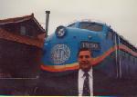
Yes Michael, that caboose is just out of frame to the right of the photo. The paint however looks better in your photo. Its looking pretty tired right now, but the interior of the caboose looks good. I got to check it out when I was there as the caboose was open.
Alrighty, here's another one! This one is near my previous photo. Its on a major county road and the town is once again quite small. The Road at the right of the photo called "Railroad Grade" is built upon a branch of a once mighty railroad in the state that was abandoned in the 50's once logging dried up. This one will lead to the final photo, where both lines converged.
Believe me if you can find this one you will LOVE the next one. More clues here that meets the eye.
Where Is It?
-
MQT1223

- O Scale Railfanner
- Posts: 4104
- Joined: Wed Sep 10, 2014 1:46 pm
- Location: Grandville, Michigan
- Contact:
Re: Where Is It?
- Attachments
-
1223 OUT! President and Founder of the Buck Creek Central, the Rolling River Route! (2012-2017) President and Founder of the Lamberton Valley Railroad, The Tin Plate Road! Proudly railfanning with Asperger's since 1996. 
-
James Sofonia
- Grand Traverse Dinner Train 1996
- Posts: 1701
- Joined: Mon Mar 10, 2014 7:56 pm
- Location: Traverse City, Michigan
Re: Where Is It?
MQT1223 wrote:railrod1949 wrote:Pixl wrote:"NOW WHICH WAY ARE WE GOING TO GO"?
Not that difficult to figure out. I just couldn't find anything else interesting to put up today.
There is rail in the photo if you look close.
Looking west on M-66 and M-72 toward US-131 after cross the Great Lake Central RR line just south of Kalkaska.
I don't live in Comins and yet I took that photo. Ya just gotta drive around and explore.
Last edited by James Sofonia on Sun Jul 31, 2016 12:59 pm, edited 2 times in total.
-
~Z~

- Sofa King Admin
- Posts: 13007
- Joined: Tue Oct 12, 2004 2:14 pm
- Location: Grand Rapids, MI
- Contact:
Re: Where Is It?
E Co Rd 612, Grayling, Michigan.MQT1223 wrote:Yes Michael, that caboose is just out of frame to the right of the photo. The paint however looks better in your photo. Its looking pretty tired right now, but the interior of the caboose looks good. I got to check it out when I was there as the caboose was open.
Alrighty, here's another one! This one is near my previous photo. Its on a major county road and the town is once again quite small. The Road at the right of the photo called "Railroad Grade" is built upon a branch of a once mighty railroad in the state that was abandoned in the 50's once logging dried up. This one will lead to the final photo, where both lines converged.
Believe me if you can find this one you will LOVE the next one. More clues here that meets the eye.
Webmaster
Railroad photos on Railroadfan.com
Railroad photos on Railroadfan.com
-
MQT1223
- O Scale Railfanner
- Posts: 4104
- Joined: Wed Sep 10, 2014 1:46 pm
- Location: Grandville, Michigan
- Contact:
Re: Where Is It?
It's actually Lovells... But yes.~Z~ wrote:E Co Rd 612, Grayling, Michigan.MQT1223 wrote:Yes Michael, that caboose is just out of frame to the right of the photo. The paint however looks better in your photo. Its looking pretty tired right now, but the interior of the caboose looks good. I got to check it out when I was there as the caboose was open.
Alrighty, here's another one! This one is near my previous photo. Its on a major county road and the town is once again quite small. The Road at the right of the photo called "Railroad Grade" is built upon a branch of a once mighty railroad in the state that was abandoned in the 50's once logging dried up. This one will lead to the final photo, where both lines converged.
Believe me if you can find this one you will LOVE the next one. More clues here that meets the eye.
1223 OUT! President and Founder of the Buck Creek Central, the Rolling River Route! (2012-2017) President and Founder of the Lamberton Valley Railroad, The Tin Plate Road! Proudly railfanning with Asperger's since 1996.
-
MQT1223
- O Scale Railfanner
- Posts: 4104
- Joined: Wed Sep 10, 2014 1:46 pm
- Location: Grandville, Michigan
- Contact:
Re: Where Is It?
Alright, this is my final entry for a while. Comins, Lovells and now this final town. No trains have been here since at least the 50's. A branch of the AuSable and Northwestern came off the original AS&NW mainline that went to Comins to interchange (which meant transloading from a 3 foot carrier to a standard gauge carrier) with the Michigan Central branchline that came through Lovells, later NYC just west of this town which is only a mile or two NE (which would be behind this photo) of the location this was taken. This line came off the mainline to Mackinaw City in Grayling by the Military Base, and is easy to follow out of Grayling as it has been turned into a road as well.
The road that runs from the bottom left to the top right was the former railroad grade and would actually cross a body of water beyond the trees if you followed the road to the top right of the picture. There is no bridge today as a house occupies the ROW and no clear evidence of one unless the water dropped significantly, however the line is very easy to see on Google Maps and still enjoys plenty of use as from cars and farther down an ORV trail beyond the water. Head to the bottom left and the road heads into town. It actually at one point goes from the MCRR grade to the AS&NW grade at the sight of the former interchange point. Don't know too many roads that use old interchanges and RR grades that used different guages! These locations are unrecognizable today as they have been wiped out completely from development.
If you can follow the AS&NW branch, hats off to you as it is nearly impossible to trace. Lovells can get tough too, so unless you know this area well you will have fun with this one. If you can read those political signs they might aid you as well. I know one of them is a Sheriff sign, can't remember the other one. The junction these two lines interchanged at also has a name and does come up as an unicorporated community. One might be able to find it if they look in the right spots. This photo is very close, if not the exact spot at that junction.
I do not believe this town has ever been mentioned once in this entire thread so this might spark some interest for some that will further explore the area.
- Attachments
-
Last edited by MQT1223 on Sun Jul 31, 2016 1:04 pm, edited 1 time in total.
1223 OUT! President and Founder of the Buck Creek Central, the Rolling River Route! (2012-2017) President and Founder of the Lamberton Valley Railroad, The Tin Plate Road! Proudly railfanning with Asperger's since 1996.
-
GreatLakesRailfan
- Railroadfan...fan
- Posts: 4829
- Joined: Wed Aug 24, 2005 12:28 am
- Location: Marysville, Michigan
Re: Where Is It?
He's not referring to your photo, Pixl, he's referring to his Coming shot and responding to the comment about not living near where the photo was taken.Pixl wrote:Dude are you really awake? Your guess of Cmmings is 100 plus miles away from Kalkaska. Duh.MQT1223 wrote: I don't live in Comins and yet I took that photo. Ya just gotta drive around and explore.
~ Charles W.
-
James Sofonia
- Grand Traverse Dinner Train 1996
- Posts: 1701
- Joined: Mon Mar 10, 2014 7:56 pm
- Location: Traverse City, Michigan
Re: Where Is It?
Ok, I get it now.GreatLakesRailfan wrote: He's not referring to your photo, Pixl, he's referring to his Coming shot and responding to the comment about not living near where the photo was taken.
-
James Sofonia
- Grand Traverse Dinner Train 1996
- Posts: 1701
- Joined: Mon Mar 10, 2014 7:56 pm
- Location: Traverse City, Michigan
Re: Where Is It?
Vienna Jct. near Lewiston. Corner of Fleming Rd. and Twin Lakes Dr. The missing bridge was a little South of the Jct. crossing the channel between East and West Twin Lakes.MQT1223 wrote:Alright, this is my final entry for a while. Comins, Lovells and now this final town. No trains have been here since at least the 50's. A branch of the AuSable and Northwestern came off the original AS&NW mainline that went to Comins to interchange (which meant transloading from a 3 foot carrier to a standard gauge carrier) with the Michigan Central branchline that came through Lovells, later NYC just west of this town which is only a mile or two NE (which would be behind this photo) of the location this was taken. This line came off the mainline to Mackinaw City in Grayling by the Military Base, and is easy to follow out of Grayling as it has been turned into a road as well.
I do not believe this town has ever been mentioned once in this entire thread so this might spark some interest for some that will further explore the area.
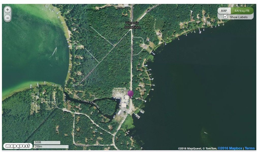
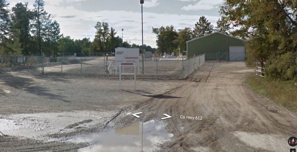
An interesting area 1223, another thing in the area is the much talked about Embridge line 5 that crosses this grade a little South of West Twin Lk.
A bit South of that crossing is the Embridge Lewiston pumping station.
-
MQT1223
- O Scale Railfanner
- Posts: 4104
- Joined: Wed Sep 10, 2014 1:46 pm
- Location: Grandville, Michigan
- Contact:
Re: Where Is It?
Well done Pixl! I wasn't expecting it to be found so quickly! I guarantee most of the people that own property around there don't know what we just talked about. Well done indeed!Pixl wrote:Vienna Jct. near Lewiston. Corner of Fleming Rd. and Twin Lakes Dr. The missing bridge was a little South of the Jct. crossing the channel between East and West Twin Lakes.MQT1223 wrote:Alright, this is my final entry for a while. Comins, Lovells and now this final town. No trains have been here since at least the 50's. A branch of the AuSable and Northwestern came off the original AS&NW mainline that went to Comins to interchange (which meant transloading from a 3 foot carrier to a standard gauge carrier) with the Michigan Central branchline that came through Lovells, later NYC just west of this town which is only a mile or two NE (which would be behind this photo) of the location this was taken. This line came off the mainline to Mackinaw City in Grayling by the Military Base, and is easy to follow out of Grayling as it has been turned into a road as well.
I do not believe this town has ever been mentioned once in this entire thread so this might spark some interest for some that will further explore the area.
An interesting area 1223, another thing in the area is the much talked about Embridge line 5 that crosses this grade a little South of West Twin Lk.
A bit South of that crossing is the Embridge Lewiston pumping station.
1223 OUT! President and Founder of the Buck Creek Central, the Rolling River Route! (2012-2017) President and Founder of the Lamberton Valley Railroad, The Tin Plate Road! Proudly railfanning with Asperger's since 1996.

-
Michael
- Railroadfan...fan
- Posts: 11027
- Joined: Sun Sep 12, 2010 2:52 pm
- Location: Plymouth, Michigan
Re: Where Is It?
Interesting crossing. It's a wide main road but doesn't merit a protected crossing or signal although just a block up road is another crossing with a the "bells and whistles" 

-
railrod1949
- Railroadfan...fan
- Posts: 1317
- Joined: Mon Oct 26, 2015 8:19 am
- Location: Waterford, MI
Re: Where Is It?
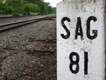
Genesee Ave., Old US 10, in Saginaw, looking west crossing the LSRC rail spur to Rifkon Scrap Iron and Metal on the left. Second track in the background is the Huron and Eastern/LSRC (former MC, former NYC). The Mid Michigan Children Museum is on the other side of the first track on the left.Michael wrote:Interesting crossing. It's a wide main road but doesn't merit a protected crossing or signal although just a block up road is another crossing with a the "bells and whistles"
-
Michael
- Railroadfan...fan
- Posts: 11027
- Joined: Sun Sep 12, 2010 2:52 pm
- Location: Plymouth, Michigan
Re: Where Is It?
Yes sir. I figured someone would recognize the museum.
railrod1949 wrote:Genesee Ave., Old US 10, in Saginaw, looking west crossing the LSRC rail spur to Rifkon Scrap Iron and Metal on the left. Second track in the background is the Huron and Eastern/LSRC (former MC, former NYC). The Mid Michigan Children Museum is on the other side of the first track on the left.Michael wrote:
-
railrod1949
- Railroadfan...fan
- Posts: 1317
- Joined: Mon Oct 26, 2015 8:19 am
- Location: Waterford, MI
Re: Where Is It?
Hints please?Michael wrote:
-
Michael
- Railroadfan...fan
- Posts: 11027
- Joined: Sun Sep 12, 2010 2:52 pm
- Location: Plymouth, Michigan
Re: Where Is It?
This was the site of a large plant that closed 10 years ago and was recently demolished.railrod1949 wrote:Hints please?Michael wrote:
Re: Where Is It?
Entrance to the Georgia Pacific plant in Gaylord.
-
railrod1949
- Railroadfan...fan
- Posts: 1317
- Joined: Mon Oct 26, 2015 8:19 am
- Location: Waterford, MI
Re: Where Is It?
Agreed! The entrance to the old Georgia Pacific plant on the west side of Dickerson Road in Gaylord. This was off the connection with the Lake States Railway.Mark F wrote:Entrance to the Georgia Pacific plant in Gaylord.
-
Michael
- Railroadfan...fan
- Posts: 11027
- Joined: Sun Sep 12, 2010 2:52 pm
- Location: Plymouth, Michigan
Re: Where Is It?
Yes. You guys are correct.
-
James Sofonia
- Grand Traverse Dinner Train 1996
- Posts: 1701
- Joined: Mon Mar 10, 2014 7:56 pm
- Location: Traverse City, Michigan
-
~Z~
- Sofa King Admin
- Posts: 13007
- Joined: Tue Oct 12, 2004 2:14 pm
- Location: Grand Rapids, MI
- Contact:
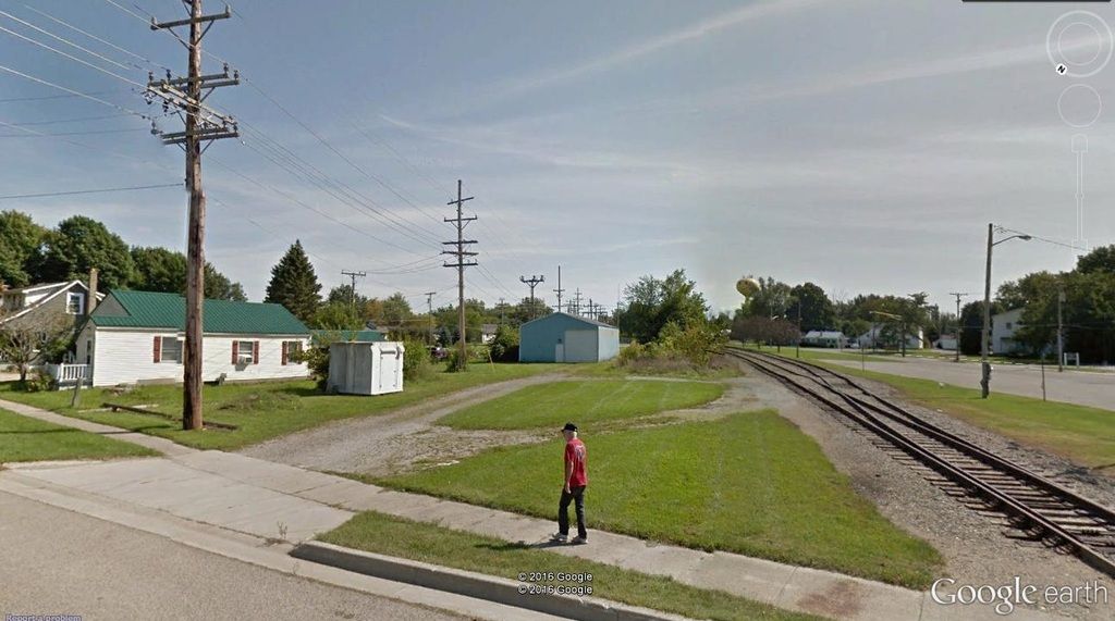
Re: Where Is It?
Main St, Millington MIPixl wrote:
No, I haven't been there before, but that giant yellow water tower helped a ton
Webmaster
Railroad photos on Railroadfan.com
Railroad photos on Railroadfan.com